
As the northern regions of the United States continue their recovery from a series of snowstorms accompanied by prolonged freezing temperatures, meteorologists anticipate the arrival of a new winter system this weekend that threatens to coat southern states with ice. This emerging storm is expected to span a wide geographic belt, ranging from Texas eastward to the Carolinas, raising alarms due to its potential to bring widespread and severe ice accumulation.
Former National Oceanic and Atmospheric Administration chief scientist Ryan Maue characterized the event as a "widespread potentially catastrophic event" and expressed uncertainty regarding the public's readiness for the impending conditions.
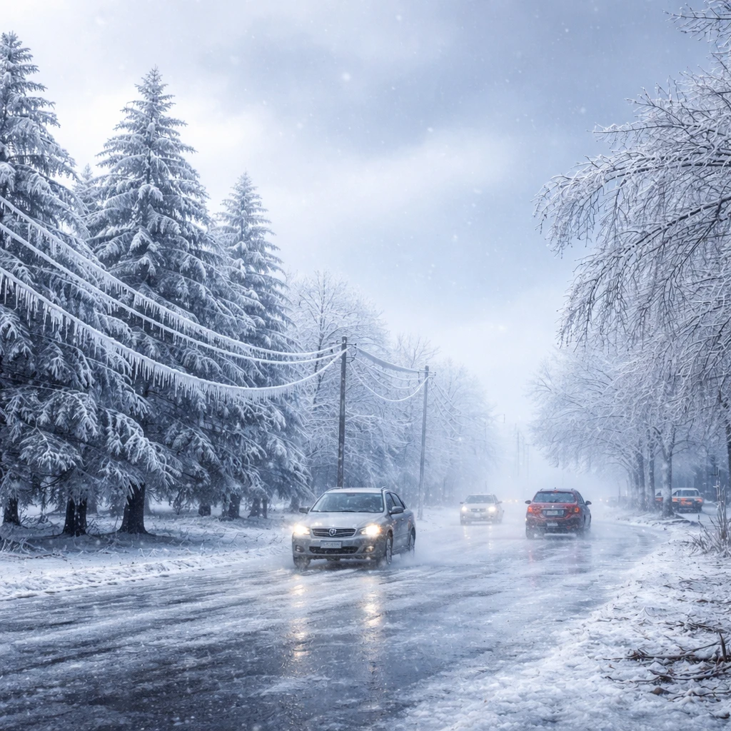
On Tuesday, officials issued warnings about the likelihood of ice potency sufficient to weigh down both trees and power lines, thereby potentially causing extensive blackouts. Keith Avery, CEO of the Newberry Electric Cooperative in South Carolina, highlighted the severity of the threat, noting that even a half-inch of ice accumulation might be damaging, and an inch could spell disaster.
The National Weather Service forecast anticipates "great swaths of heavy snow, sleet, and treacherous freezing rain" beginning Friday across much of the central United States before shifting towards the East Coast by Sunday. Persistently cold temperatures are expected to slow the melting process, allowing ice and snow to remain on roads and walkways longer, exacerbating the risk of accidents and infrastructure strain.
Despite ongoing forecasting efforts, precise predictions remain challenging, particularly regarding the delineation of precipitation types, with some areas expected to receive rain while adjacent locations could experience dangerous ice buildups.
The core driver behind this severe weather is an unusually cold Arctic air mass advancing southward from Canada. This frigid air is projected to clash with moisture-laden air moving east from the Gulf of Mexico across the southern states. National Weather Service meteorologist Bryan Jackson indicated that the degree of cold infiltrating the region is notable even given the typical winter season severity. The convergence of cold temperatures with substantial moisture influx creates conditions ripe for a major winter storm accompanied by impactful ice accumulation.
Forecasters predict the setup might resemble an atmospheric river—a concentrated flow of moisture—extending over the southern states. This would channel precipitation from Texas along the Gulf Coast and onward through Georgia and the Carolinas. The Atlanta office of the National Weather Service underscored growing concerns about the potential for a significant ice storm in North and central Georgia.
If substantial ice accumulates in metropolitan Atlanta, challenges may persist into early next week due to forecast lows near 22 degrees Fahrenheit (-5.6 Celsius) on Monday and highs hovering only around 35 degrees Fahrenheit (1.7 Celsius), hindering ice melt. Such conditions are problematic for transportation and power infrastructure.
Transportation disruption is a key concern with this storm, particularly given that southern states generally possess fewer resources and less equipment for ice and snow removal. Extended cold spells after the storm could prolong hazardous road conditions. Previous incidents, such as a large multi-vehicle crash in Michigan involving over 100 vehicles, demonstrate the dangers posed by icy conditions, and officials expect similar travel complications may arise in the southern states during this event.
Major airport hubs at Dallas, Atlanta, Memphis (Tennessee), and Charlotte (North Carolina) stand to face operational disruptions due to the storm's effect on travel.
Meanwhile, northern states are already grappling with extreme cold, and the forthcoming Arctic air mass is expected to deepen the freeze, further cementing winter conditions across a wide Northern swath. According to meteorologist Jackson, a significant low-pressure system over Hudson Bay is a driving force influencing weather patterns across North America at this time.
Texas is anticipated to encounter some of the storm’s initial impacts starting Friday, including the push of Arctic air southward across much of the state. In conjunction with incoming rain, the combination sets up the potential for mixed precipitation and progressively colder temperatures, dropping into the teens and twenties Fahrenheit through Saturday in some northern locations. Forecasting the storm’s precise intensity and the extent of ice or snow accumulation in north and central Texas remains complex and subject to uncertainty.
Supporting the community preparation efforts, retailers in regions such as Little Rock, Arkansas report increased consumer demand for winter supplies, including sleds for children, shovels, ice melt products, and protective equipment for plumbing designed to prevent freezing. Anticipated temperatures in Little Rock are forecast to fall into the teens, highlighting the need for such preparations.
Given the broad scope of this potentially severe storm system, public safety officials and meteorologists advise residents across affected areas to remain vigilant, heed weather warnings, and prepare for significant disruptions due to ice accumulation, outages, and hazardous travel conditions.